Boise: Areas With Poor Library Access
 Area #1: Highlands Area #2: East End Area #3: Columbia Village Area #4: Boise Airport Area #5: West Boise Boise Main Library Bown Crossing Library Hillcrest Library Collister Library Garden City Library Cole & UStick Library 5 Mile & Overland Library Meridian Silverstone Eagle Library Orchard Park Meridian
Boise: Areas With Poor Library Access
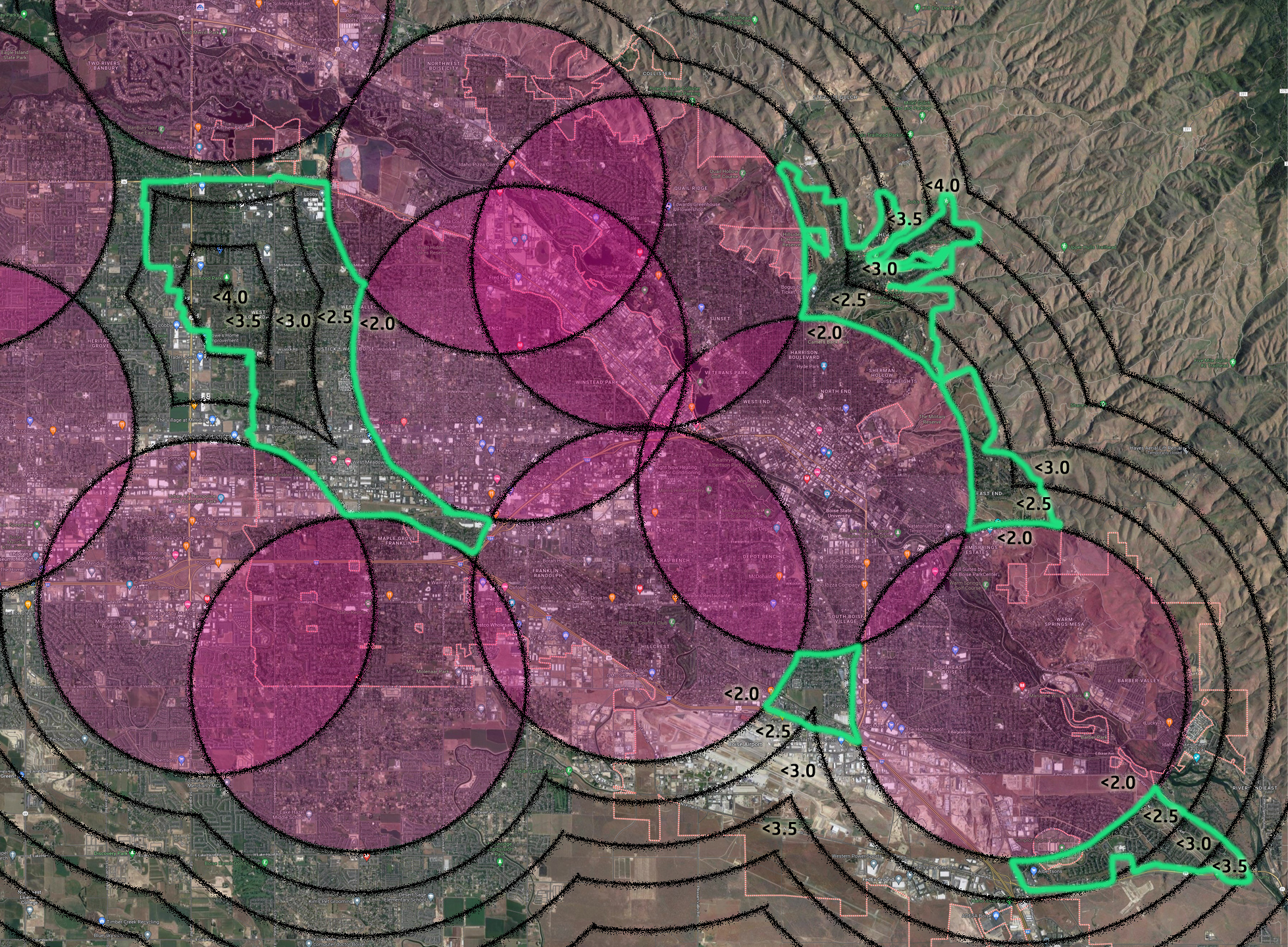
This page shows the 5 areas of Boise that are > 2 miles from a library.
- Population is estimated based on 2020 census data.
- Distance is population multiplied by distance, using the distance rings shown.
This map shows the 5 areas of Boise that are > 2 miles from a library.
- Population is estimated based on 2020 census data.
- Combined Distance is population multiplied by distance, using the rings shown. This is the number of miles to travel for everyone in this area to reach their nearest library.
Why use a 2 mile radius?
- At 2 miles we see some overlap between coverage, but not huge overlap. At a 3 mile radius almost all areas of the city have coverage, with much of the city having access to 3, 4, or even all 5 libraries!
- 2 miles is a pretty comfortable biking distance.
- Similar sized cities seem to have very good coverage using a 2 mile radius
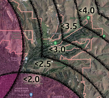
Area #1: Highlands
- Bogus Basin Road
- Simplot Hill
Population (est): 2,040
Combined Distance: 6,030 miles
Area #2: East End
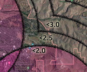
The area of the East End north of the Old Idaho State Penitentiary.
Population (est): 780
Combined Distance: 1,995 miles
Area #3: Columbia Village
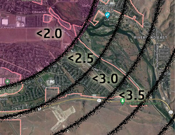
About half of Columbia Village is > 2 miles from the Bown Crossing Library. However, due to limited bridges over the New York Canal, driving distance is increased to 5 miles.
Population (est): 2,175
Combined Distance: 5,775 miles
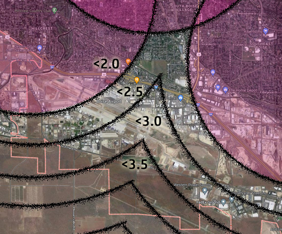
Area #4: Airport
This is a relatively large area but only has a small residential population, north of the airport.
Population (est): 900
Combined Distance: 2,250 miles
Area #5: West Boise
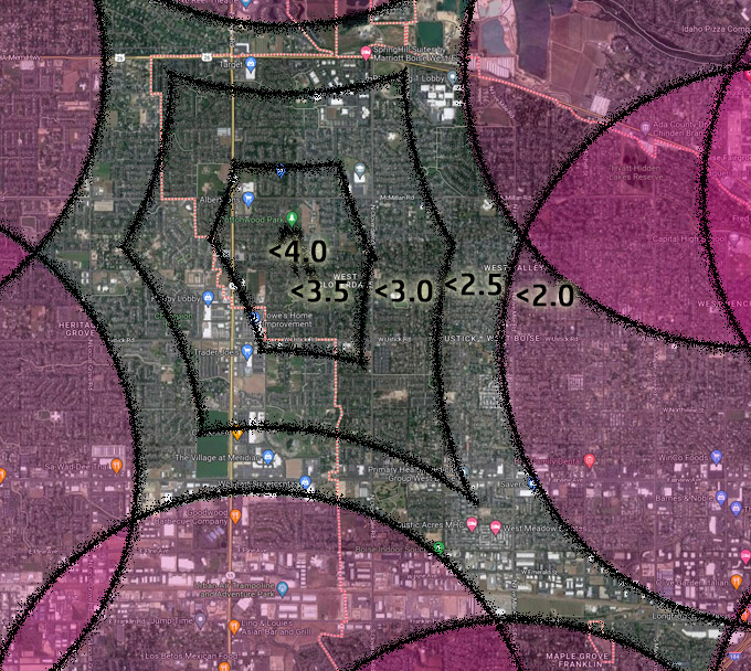
The area of Boise north of Fairview and west of 5 Mile more than 2 miles from Cole & UStick and Garden City Library.
Population does not include Eagle / Meridian citizens.
Population (est): 27,450
Combined Distance: 80,273 miles
Summary: Citizens with Poor Library Access
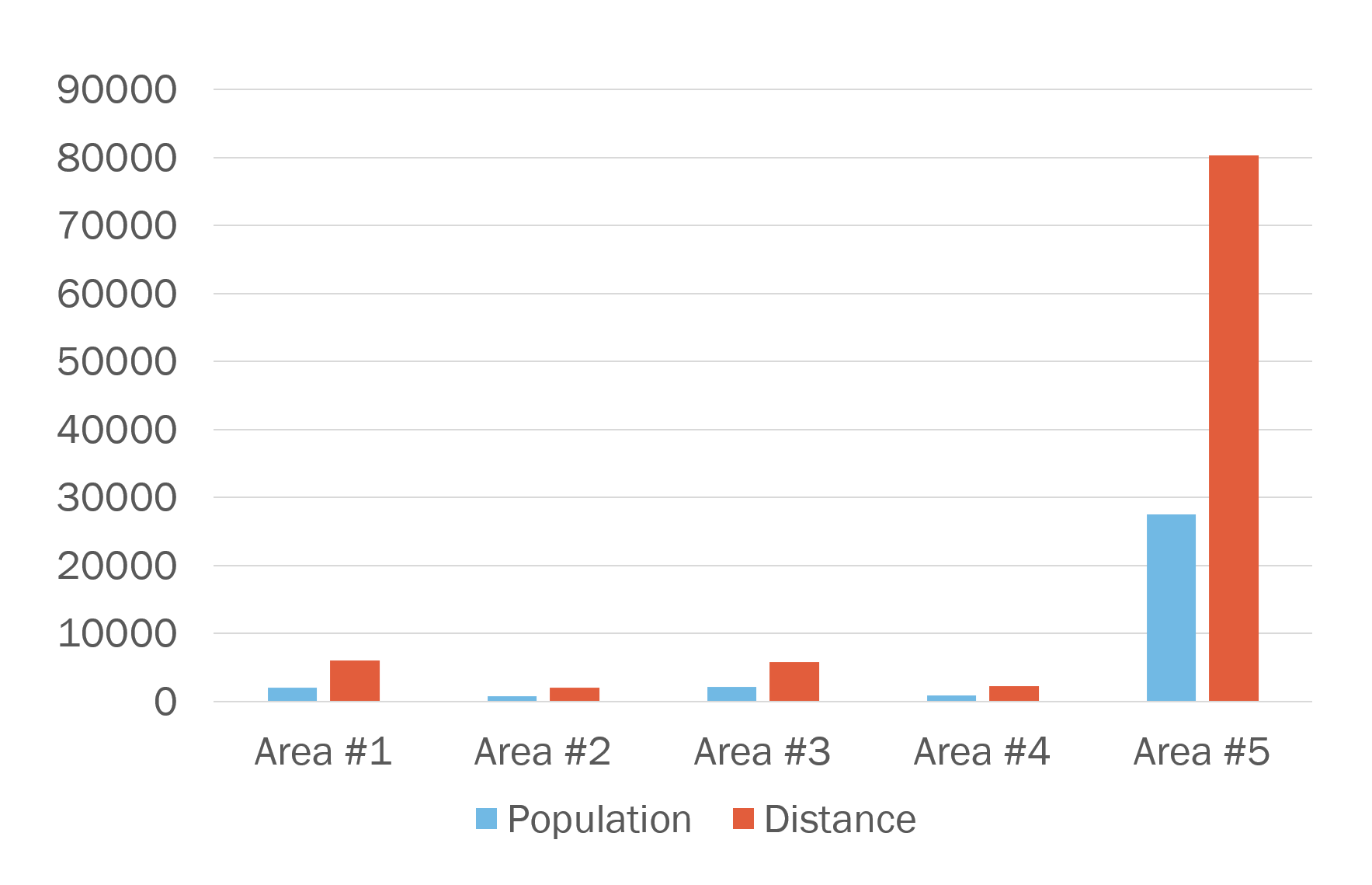
This chart shows the population and combined distance citizens in each area would need to travel to reach a library.

Social Contact